Rongai route
The 6-day Rongai route starts at Rongai Gate (Nale Moru) and finishes at Marangu Gate. It covers about 67 km (42 mi), reaches Uhuru Peak (5,895 m) via Gilman's Point, and costs $1,750 per person.
The only route from the north, close to the Kenyan border. Quieter and drier than the southern routes, with a night under Mawenzi's spires on the 7-day version. You descend via Marangu.
Key facts
- Duration
- 6 days
- 5 nights on the mountain
- Total distance
- 67 km
- 42 mi, the daily distances added up
- Highest point
- 5,895 m
- 19,340 ft, Uhuru Peak
- Summit via
- Gilman's Point
- Sleeping in
- Tents [Last night at Horombo: hut or tents? TBC]
- Price per person
- $1,750
6-day Rongai route
$1,750
per person
Prices can change for larger groups. Message me for your final price.
Book on WhatsAppOff the mountain I reply within a couple of hours. I'm on the mountain a lot, though, and on a climb I may only have signal once a day or every few days.
6 or 7 days?
The 7-day version goes via Kikelewa and Mawenzi Tarn (4,330 m), which adds a day to acclimatise. The 6-day version goes straight from Third Cave to Kibo Hut. More days give you a better chance of reaching the summit. In the end it is your choice, but if you are at all concerned, or not a very fit or experienced hiker, I recommend the 7 days.
What does the price include?
- Park fees
- All meals on the mountain
- Crew wages
- Sleeping tents
- Sleeping mattress
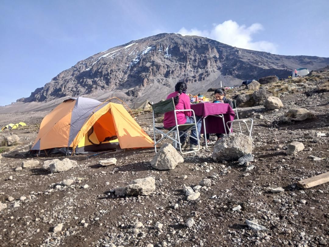
- Dining tent with table and chairs
- Transport from your hotel to the gate and back
Not included: Tips for your crew, travel insurance, gear (you can rent it from me), hotel nights before and after the climb, and any transport other than to and from the start and finish gates, such as airport transfers.
How high does the Rongai route climb?
| Day | Stage | Start | Highest point | End |
|---|---|---|---|---|
| 1 | Rongai Gate (Nale Moru) to Simba Camp | 2,000 m | 2,650 m | |
| 2 | Simba Camp to Second Cave | 2,650 m | 3,450 m | |
| 3 | Second Cave to Third Cave | 3,450 m | 3,870 m | |
| 4 | Third Cave to Kibo Hut | 3,870 m | 4,720 m | |
| 5 | Kibo Hut to Uhuru Peak to Horombo Hut | 4,720 m | 5,895 m | 3,700 m |
| 6 | Horombo Hut to Marangu Gate to your hotel | 3,700 m | 1,860 m |
[ROUTE MAP: Rongai Gate (Nale Moru), Simba Camp, Second Cave, Third Cave, Kibo Hut, Uhuru Peak, Horombo Hut, Marangu Gate]
What happens each day on the 6-day Rongai route?
Day 1: Rongai Gate (Nale Moru) to Simba Camp
The drive to the wooden village of Nale Moru takes about 2 hours, including a stop at Marangu for permits. After signing in and preparing the porters, we start on a wide path through fields of maize and potatoes, then into pine forest.
The track climbs gently but steadily through forest with plenty of wildlife. As the trees thin out we reach Simba Camp, at the edge of the moorland, with wide views over the Kenyan plains.
- Altitude
- 2,000 to 2,650 m
- 6,560 to 8,700 ft
- Distance
- 6 km / 4 mi
- Hiking time
- 3–4 hours
- Habitat
- Montane forest
- Meals
- Lunch, dinner
Day 2: Simba Camp to Second Cave
A steady morning climb to Second Cave, with superb views of Kibo and the eastern ice fields on the crater rim.
- Altitude
- 2,650 to 3,450 m
- 8,700 to 11,300 ft
- Distance
- 6 km / 4 mi
- Hiking time
- 3–4 hours
- Habitat
- Moorland
- Meals
- Breakfast, lunch, dinner
Day 3: Second Cave to Third Cave
A shorter day across the moorland from Second Cave to Third Cave.
- Altitude
- 3,450 to 3,870 m
- 11,300 to 12,700 ft
- Distance
- 9 km / 6 mi
- Hiking time
- 2–3 hours
- Habitat
- Semi-desert
- Meals
- Breakfast, lunch, dinner
Day 4: Third Cave to Kibo Hut
We climb to Kibo Hut at the foot of the Kibo crater wall and spend the rest of the day resting before a very early start.
- Altitude
- 3,870 to 4,720 m
- 12,700 to 15,500 ft
- Distance
- 5 km / 3 mi
- Hiking time
- 3–4 hours
- Habitat
- Alpine desert
- Meals
- Breakfast, lunch, dinner
Summit day
Day 5: Kibo Hut to Uhuru Peak to Horombo Hut
We start between midnight and 2 am, climbing steep, heavy scree (sometimes snow) with many switchbacks to Gilman's Point on the crater rim. It is dark and very cold until we start descending, so you need a headlamp and all your warm layers. This is by far the hardest part of the trek. Go pole pole, slowly, and stay positive.
From Gilman's Point we continue along the crater rim to Uhuru Peak, the highest point in Africa, with incredible views on every side.
Then we descend, stopping for lunch and a rest at Kibo Hut, before continuing to Horombo Hut.
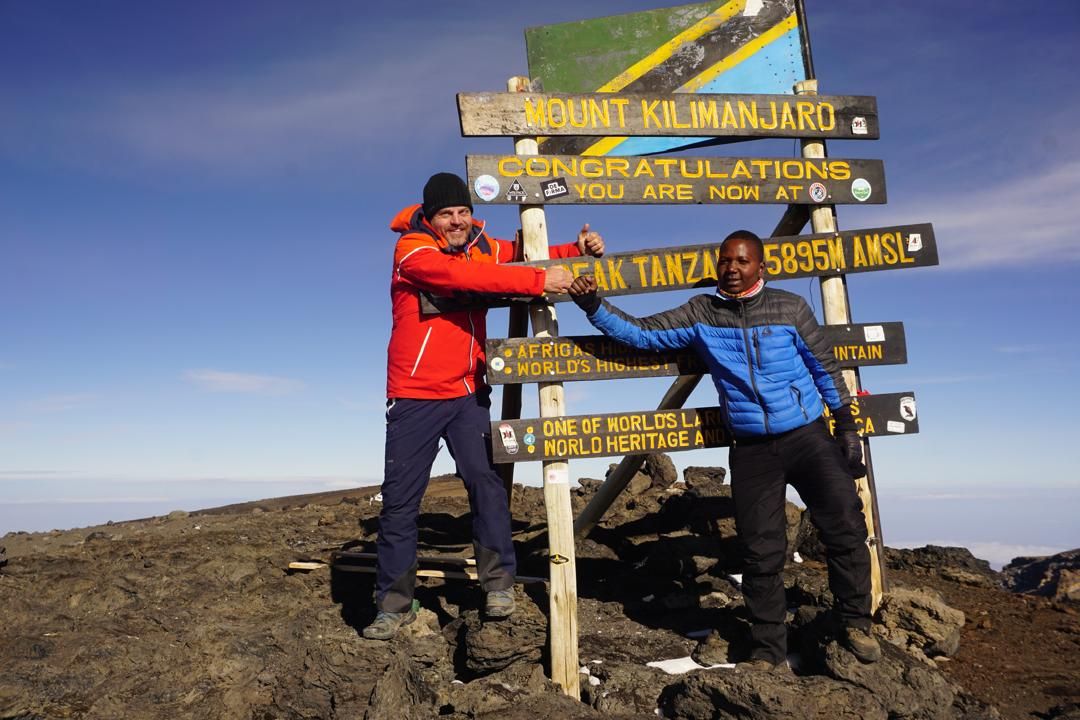
Joseph (right) at Uhuru Peak, 5,895 m. - Altitude
- 4,720 to 5,895 to 3,700 m
- 15,500 to 19,340 to 12,200 ft
- Distance
- 6 km up, 15 km down
- Hiking time
- 6–8 h up, 6–8 h down
- Habitat
- Alpine desert
- Meals
- Breakfast, lunch, dinner
Day 6: Horombo Hut to Marangu Gate to your hotel
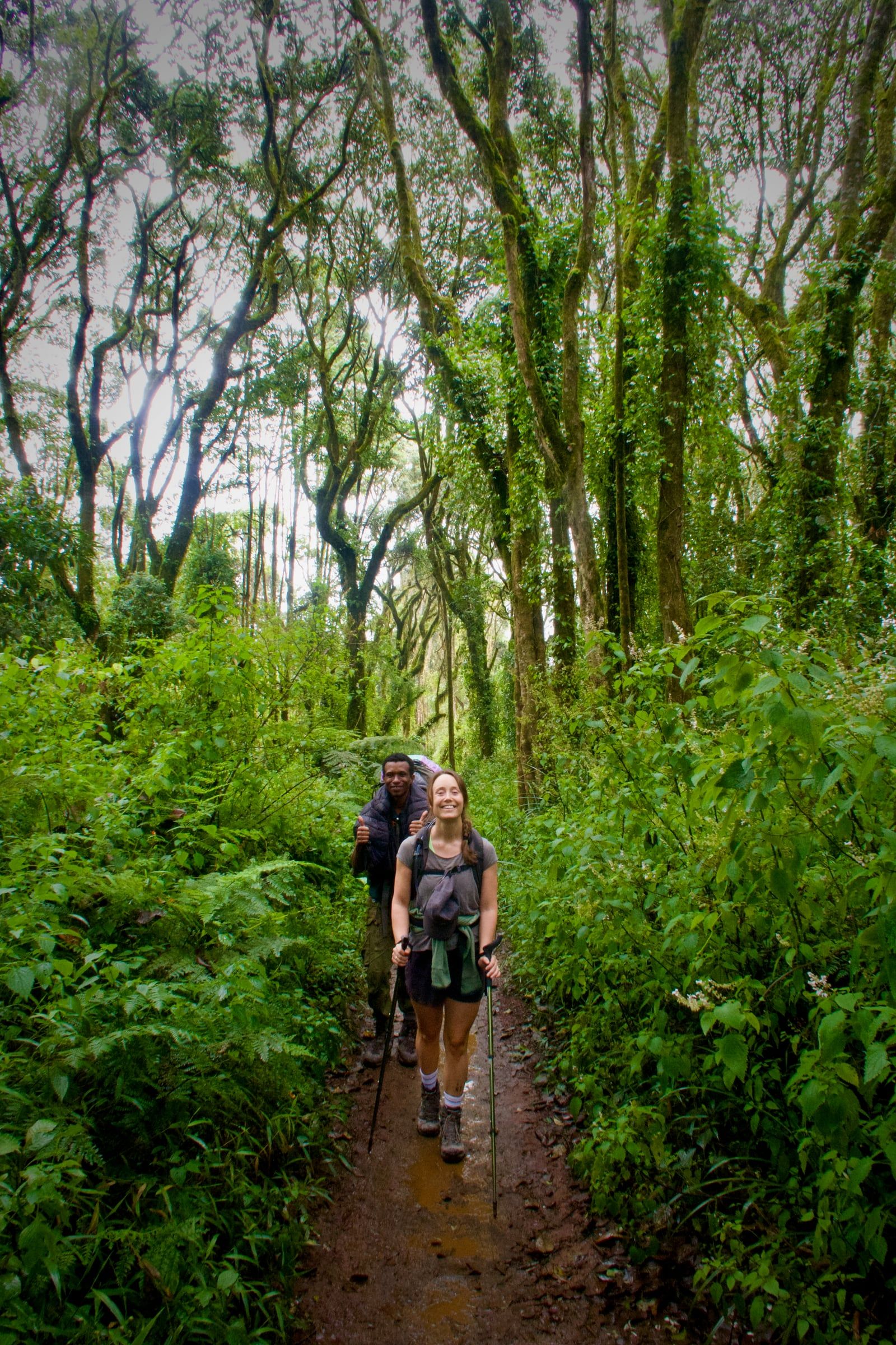
A steady descent through the moorland to Mandara Hut, then through lush forest to the park gate at Marangu. Lower down it can be wet and muddy, so gaiters and poles help. Shorts and a T-shirt are usually enough, but keep rain gear and a warm layer handy.
A vehicle meets you at Marangu Gate to drive you back to your hotel in Moshi, about 1 hour.
- Altitude
- 3,700 to 1,860 m
- 12,200 to 6,100 ft
- Distance
- 20 km / 12.5 mi
- Hiking time
- 4–5 hours
- Habitat
- Forest
- Meals
- Breakfast